I-635 main lane utility relocation
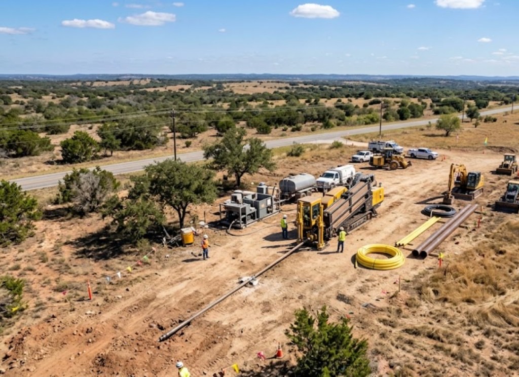
TxDOT relocations move water, electric, and telecom under main lanes and frontage roads near LBJ corridor. HDD reduces closure footprint — DART coordination when alignments require.
Garland, TX · Dallas County
River, highway, and railroad crossings in Garland — Lake Ray Hubbard shoreline, I-635, I-30, and rail spurs with TxDOT permits and DART coordination planned months ahead.
River, highway, and railroad crossing bores in Garland meet TxDOT Dallas District, DART rail engineering, and lake shoreline environmental rules. Engineered scopes — MOT, casing spec, and Firewheel traffic plans often take longer than the physical bore.
Directional Boring Texas scopes long-span HDD and jack-and-bore crossings with profiles, traffic control, and LBJ rail awareness visible in the quote. Shoreline alluvium, blackland clay, and I-635 congestion define how Garland crossings are staged.
Real Dallas County angles — not generic statewide copy.
TxDOT relocations move water, electric, and telecom under main lanes and frontage roads near LBJ corridor. HDD reduces closure footprint — DART coordination when alignments require.
Shoreline utilities need environmental compliance and bank protection. Entry shafts set back from slopes; dewatering planned for alluvium entries.
Railroad templates specify casing, flagging, and installation windows. Rigs mobilize after agreements — lead time exceeds bore duration.
Feeders cross frontage and interchanges with stacked shallow utilities. TxDOT and city MOT combine with remark-intensive locate work.
Engineered alignment and geotech guide rig class and casing. TxDOT and railroad permits precede mobilization. Shoreline-adjacent drilling pauses when storm events saturate low entries.
Blackland clay with Austin Chalk toward the west, softer alluvium near the lake — dual personality soils in one city.
Garland profiles shift from blackland clay inland to softer alluvium near Ray Hubbard and creeks. Clay needs frac-out control; alluvium needs collapse prevention with careful ream pacing. Austin Chalk stringers appear west toward Richardson border. Lake-adjacent bores may require dewatering. We do not use one soil model for the whole city.
Metroplex hail, thunderstorms, and lake-effect humidity near Ray Hubbard influence Garland boring and restoration timing.
Spring hail delays restoration. Lake-adjacent humidity after storms softens entries. Summer heat restricts asphalt work on south Garland arterials.
City of Garland Engineering, Dallas County, TxDOT Dallas District on I-635 and I-30, and lake shoreline ROW sensitivity.
City of Garland Engineering permits ROW work. Dallas County handles pockets outside limits. TxDOT Dallas District governs I-635 and I-30 crossings. Lake shoreline and creek alignments may trigger additional environmental sensitivity — share maps early.
Open-cut across I-635 or lake shoreline ROW is rarely permitted full width. Creek open trenching triggers environmental issues — trenchless is default when agencies allow.
Length, diameter, groundwater, environmental windows, traffic control, rail flagging, engineering, and inspection.
We review plans, bore path, access, existing utilities, and owner goals — residential repair or engineered crossing.
Texas dig law compliance: ticket, wait period, verify marks, pothole at conflicts before steel or bit enters ground.
Alignment, profile, soil expectations, permit needs, and crossing agreements for roads, rails, or waterways.
Right rig for length and diameter — mini-HDD for tight urban shots, larger spreads for long pulls and reams.
Steerable pilot, survey checks, reaming passes as required for product pipe or casing diameter.
HDPE fusion, steel casing, conduit bundles, or carrier pipe installed per spec with pullback monitoring.
Alignment records, mandrel or pressure tests where spec requires, as-built for owners and inspectors.
Minimal surface disturbance philosophy — compact entry/exit pits, restore hardscape and landscape per scope.
TxDOT MOT and utility agreements often need weeks to months.
Yes with environmental compliance and bank stability review. Groundwater may shift schedules.
DART and railroad agreements frequently exceed field duration.
Agency and railroad spec often dictates casing pushes.
Span, diameter, shoreline dewatering, permits, rail coordination, MOT, and casing drive price.
24/7 — Emergency dispatch statewide. Tell us your bore path, pipe size, and city — a specialist calls or texts back with a straight answer.
Free bore estimate
Step 1 of 2 — project details first